


Ours has been running since 2005, and here to stay. The clean, fast interface you remember, with features the Bureau of Meteorology never had.
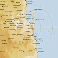
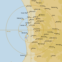
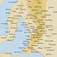
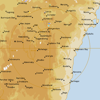
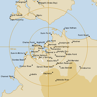
Pick your city to open the classic radar.
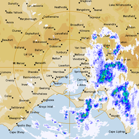
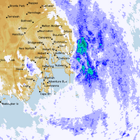
The rainfall reflectivity scale is the one you remember. High values look severe because they are severe. We never recoloured it.
When BoM redesigned, we didn't. This is the radar interface we've been running since 2005, and we're keeping it. We make changes around it (better radar quality, faster image loops, mobile features), but the page you came here for stays the page you came here for.
BoM's radar pages were the starting point. Open any radar on this site and you'll find a radar forecast, suggestions for the next-closest radar when one's down, and plenty more we've added since 2005 that BoM never offered.
Tap your browser's "Add to Home Screen" option to install The Weather Chaser as a phone app. Works offline if your connection drops mid-storm, so the last radar you viewed stays viewable.
When weather is coming, you don't want to wait. Pages load in a hurry on phone or desktop, even when the network's busy.
Yes. We source radar imagery directly from the Bureau of Meteorology's data feeds. The interface is ours; the radar data is BoM's, just rendered the way it used to be.
BoM launched a redesigned site on 22 October 2025. The new radar used a different colour scale (which made many storms look weaker than they were), reorganised the layout, and ran with noticeable lag. After widespread complaints (including from the Federal Environment Minister and state emergency services) BoM reverted the default colour scheme back to the standard dBZ on 1 November 2025. The broader site redesign remains.
We've been running this radar interface since 2005 because it works, and because tens of thousands of people use it every week. When BoM redesigned, we didn't.
The radar viewer is free, including the 256 km rain rate loops. A free account adds longer history. Paid tiers add HD radar imagery, four-hour history, and data exports, but the core viewer that brought you here stays free.
Yes. Add it to your phone's home screen and it works like an app, including limited offline support. How to install on your phone →


 Dark mode
 Light mode
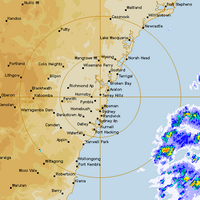
 Live weather map